|
Raspberry Lake: The Siskiyou’s secret paradise
 |
Zach Urness/Daily Courier
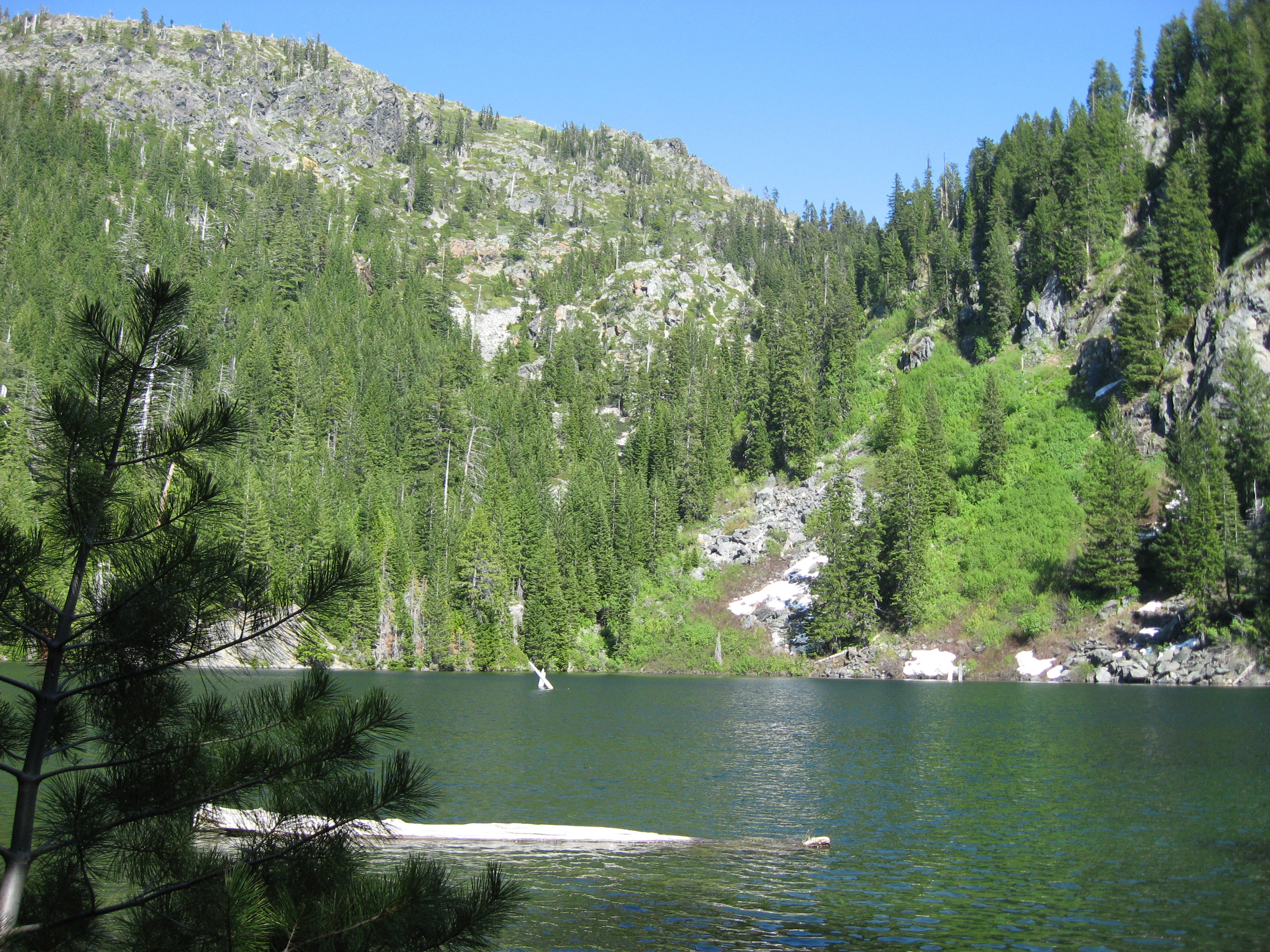
Raspberry Lake is located in the Siskiyou Wilderness just south of the Oregon border in Northern California. |
Few lakes in the Siskiyou Mountains can match the profound beauty of Raspberry Lake, a deep turquoise pool hidden in the wilderness. I backpacked there during an unforgettable trip in early June. Click here for a photo gallery of the Siskiyou Wilderness.o o o oBy Zach Urness of the Daily CourierAfter one night of camping on the shores of Raspberry Lake, I am hiking back toward my car when I meet three fellow backpackers.They’re sitting on a rock beside the Young’s Valley trail in the Siskiyou Wilderness, munching on some granola beneath the craggy cliffs of El Capitan. We chat briefly about the area’s best campsites when Jim, the group’s most talkative member, asks me about the notepad in my hand. “I’m an outdoor writer for the newspaper in Grants Pass,” I say. “That sounds great,” says Jim, peering at me through oval shaped gasses. “But does that mean you’re writing a story about this area ... about Raspberry Lake?” “That’s the plan,” I reply. “Well ... I know it’s your job,” he says. “But this area’s so beautiful and still pretty unknown. If you could try not to publicize it too much, we’d appreciate it.” Raspberry Lake is a deep blue paradise nestled snugly among the peaks of the Siskiyou Mountains. Marble cliffs jet straight upward from its shorelines and wrap the azure waters in a giant cylinder of rock and pine. On clear evenings, the sun throws an orange glow upon the rock face of Preston Peak — which at 7,309 feet is the highest point in the Siskiyou Wilderness — while silver trout make plop noises as they snatch bugs from the water’s surface. It’s the kind of place that would be surrounded by million-dollar homes or littered with cabins were it anywhere near a paved road. But like all great backcountry spots, Raspberry Lake is not willing to give itself up easily. It demands a solid effort for those wishing to bask near its snow-fed waters. Trailhead to Young’s Valley (3 miles, 900-foot elevation drop) The day before I meet Jim, my trip begins at the Young’s Valley trailhead, 14 miles up Knopki Creek Road, just south of the Siskiyou summit tunnel. The Young’s Valley trail actually is an abandoned road that leads to the defunct Chrome Mine. I hike eastward 1.5 miles to a point at about 5,500 feet and am greeted with an open panorama of Young’s Valley. The thick walls of El Capitan dominates the landscape like a giant rock ship on the horizon while the snowy spike of Copper Mountain pierces the southeastern sky. Looking down from this perch, I can see my trail’s descent before making a horseshoe turn around the valley and swinging south toward Raspberry Lake. By 11 a.m., the sun is baking the dry terrain with 85- to 90-degree waves of heat. There is limited shade along this abandoned road because Douglas fir and white pine have not yet reclaimed this route. I follow the trail as it drops about 900 feet to the grassy bottom of Young’s Valley. There are blue, gold and white wildflowers peppering the ground. I curve around the valley past the tiny clear creek and begin walking south under the shadow of El Capitan. Young’s Valley to Raspberry Lake (4.1 miles, roughly 900-feet elevation change) As I walk steadily upward, the trail increasingly is covered with large cedar and Douglas fir trees. The breeze carries the smell of warm pine sap. Suddenly, I see a small black bear sitting on the trail roughly 100 feet away. I kick at some rocks. He perks up at the noise, and I can see his tan, button-nose face. He looks like a fuzzy black pillow as he tumbles away. Worried about the chance of meeting a protective mother bear, I grab the thin red can of Bear Spray from my pack. Bear Spray basically is pepper spray on steroids. It’s advertised as “Grizzly-tough spray to deter bears from attacking humans.” This means that if you ever have to use your Bear Spray, you’re likely being stormed by an angry bear intent making you an evening entrée. I’ve always been a little skeptical that anyone would feel confident using this little red canister to defend themselves from bloody death. Still, I keep mine ready for the next half a mile. The abandoned road ends at the Chrome Mine, which now is nothing but a pile of rotting wood and rusted steel. The final trail is a thin, steep and scraggly maze that plows through the forest for about 1.5 miles. It’s a frustrating little trail, especially at the end of a long, hot hike. I scramble up a rocky section, over the top of large snow drifts — one of which I sink into — and eventually over a rise and onto a nice trail that leads to the lake. The final descent makes it all worth while. Vistas of the Siskiyou giants rise mightily on my right. Puffy white blooms of sweet-smelling azaleas line both sides of the trail as if to welcome you after a long journey. Then, through the tips of pine trees, I begin to see the sparkling blue waters of Raspberry Lake. I rush down the final series of switchbacks to the shoreline where I find a little marble outcropping, toss off my pack and dive headlong into the snow encrusted water. Later I’ll make camp on the lake’s east side and enjoy fishing in the warm mountain twilight. Tomorrow I’ll meet Jim and his friends, the only people I’ll see on my trip. And while I understand Jim’s concern about keeping this area unknown to the masses, Raspberry Lake is a gem too glorious to hide from those willing to find it.
|