|
GPS devices both a blessing and curse on the trail
 |
|
GPS devices have become more and more popular for use in the outdoors. |
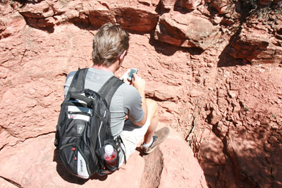
A few months ago, I bought a handheld GPS for hiking, hunting and mountain climbing. The results have been positive, except for the natural problem of becoming overdependent on the technology ... and what happens when it suddenly stops working. o o o oBy Zach Urness of the Daily CourierI was hiking through the Sky Lakes Wilderness this past weekend when something potentially catastrophic happened.I dropped my handheld Global Positioning System on a rock, momentarily breaking the small device popular for hiking, hunting and mountain climbing.All of a sudden, the screen that allows me to view my position via satellite froze up. I couldn’t access the map, compass or route back to my car.This was embarrassing.Since I bought my Garmin Oregon 400t a few months ago, I’ve barely glanced at a physical map. The GPS has made navigating the woods so easy that once it failed, I felt almost blind.Somewhere, my father was shaking his head.It hasn’t always been this way. Despite growing up in a generation obsessed with the newest iPad and smart phone, I’ve resisted the siren song of new gadgetry.I have no Internet connection at home and get my television channels through a “rabbit ears” antenna.If that’s not enough to cement my dinosaur-era credentials, consider that I also work for — wait for it — a printed newspaper!(An alarming number of my friends view newspapers as something that should exist only on the Internet).Despite this old-school predilection, I’ve had my eye on a handheld GPS for quite some time.Most readers of this column know I spend an inordinate amount of time exploring Southern Oregon’s wildest spaces. And for that type of lifestyle, a GPS really is a helpful device.There’s just so many cool applications.When you’re on the trail, you can look at exactly where you are, and a topographic map of everything around you.You can chart your foot speed, elevation and mark points of interest. Going off trail is so easy that it almost feels as though you’re cheating.Once you get back home, there’s even more toys to play with.You can break down mileage and save your favorite hikes. By using the mapping software, you can create routes that lead to highly remote areas, then download it onto the device.It’s a tad nerdy, but loads of fun.There is a problem, of course. And that comes from becoming overdependent on GPS.In the same way computers have degraded our penmanship, so too can using a GPS slowly dig into our navigating skills.Before I bought the device, I would put in a ton of work preparing for backpacking trips, especially those that included going off-trail.I have a lingering fear of getting lost in the wilderness. And so I bought the best maps available constantly checked my position with a compass and flagged the living daylights out of any off-trail routes.With a GPS, though, that amount of work just isn’t necessary. The process becomes so easy that even with the best intentions, it can lead to carelessness.Which of course brings me back to the Sky Lakes Wilderness, and the natural problem of electronic devices.Whether by running out of batteries or dropping it onto a rock, there’s always the chance that the GPS will stop working.What then?Luckily, I was on the trail when my GPS hit the skids. There were only two miles to the trailhead and there really was no danger.But the experience give me pause. What if I would have been climbing some remote peak, miles away from the trail without a good idea of my location?Technology can be great, but it’s always important to have a backup plan.
| |
|